В «Жигулёвской Долине» рассказали о технологиях разрешения конфликтов
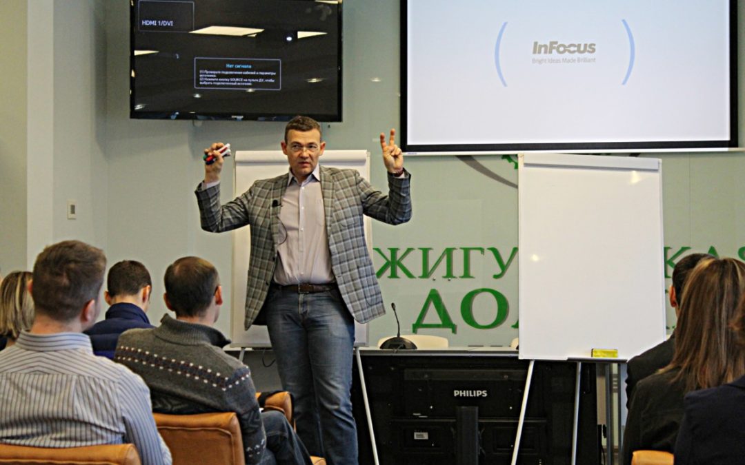
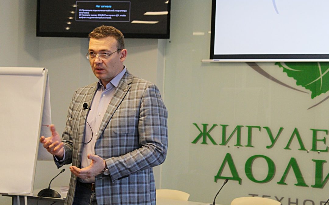
Вчера, 21 декабря 2017 года, в пресс-центре технопарка «Жигулёвская Долина» прошел семинар «Технология разрешения конфликтов в жизни, бизнесе и карьере». Спикером мероприятия выступал Руслан Хоменко.

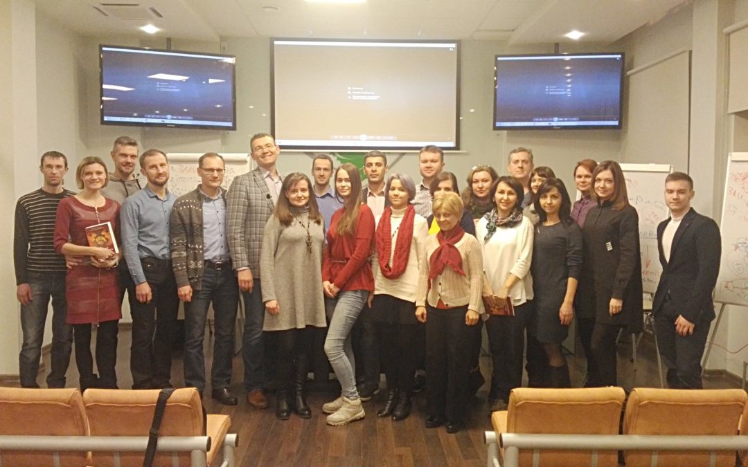
Резиденты технопарка и гости «Жигулёвской долины», принявшие участие в бесплатном семинаре, получили навыки перехода от защиты в конфликте и привычки оправдываться, к эффективной речевой самообороне.
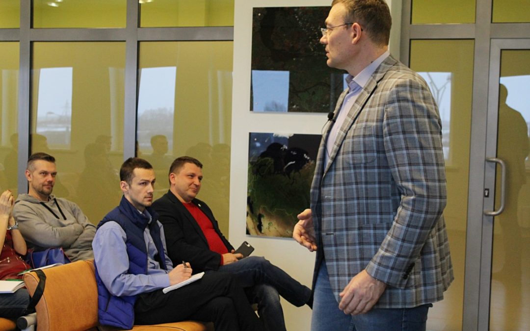
В ходе восьмичасового мероприятия спикер активно общался с аудиторией, рассказывая о собственном опыте ведения переговоров, а также разбирая жизненные ситуации от слушателей.

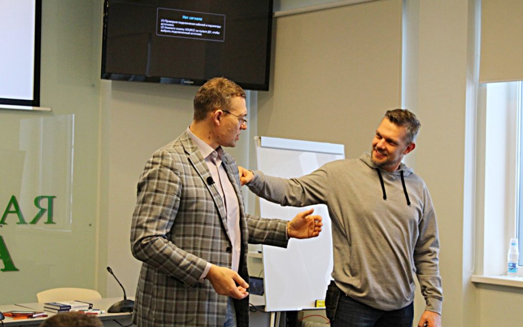
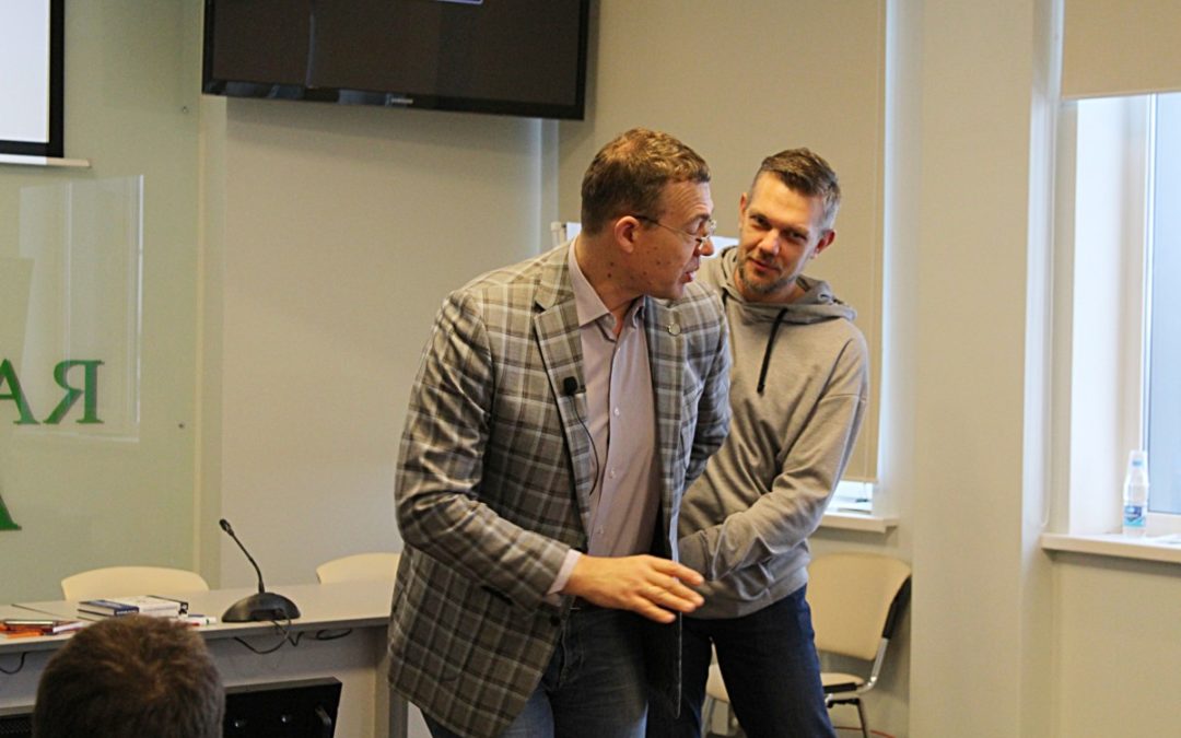
На примере рукопашной схватки с одним из гостей, Руслан дал понять, что приемы в физической борьбе и речевой самообороне очень схожи.
В качестве примеров выхода из сложных конфликтных ситуаций демонстрировались фрагменты фильмов о САМБО и эпизоды из выступлений Президента России Владимира Путина.
Данное мероприятие было ориентировано на тех, кто руководит, выступает публично, участвует в переговорах, продаёт, обучает, общается с людьми.

«Технология разрешения конфликтов в жизни, бизнесе и карьере» — это не первая встреча, проведенная технопарком и Русланом Хоменко для гостей «Жигулёвской долины» и компаний-резидентов. Ранее Руслан проводил в технопарке мастер-классы и семинары по темам «Продающая презентация» и «Харизматичный оратор».

-
- Credit NASA Goddard Space Flight Center Image by Reto Stöckli (land surface, shallow water, clouds). Enhancements by Robert Simmon (ocean color, compositing, 3D globes, animation). Data and technical support: MODIS Land Group; MODIS Science Data Support Team; MODIS Atmosphere Group; MODIS Ocean Group Additional data: USGS EROS Data Center (topography); USGS Terrestrial Remote Sensing Flagstaff Field Center (Antarctica); Defense Meteorological Satellite Program (city lights). This spectacular “blue marble” image is the most detailed true-color image of the entire Earth to date. Using a collection of satellite-based observations, scientists and visualizers stitched together months of observations of the land surface, oceans, sea ice, and clouds into a seamless, true-color mosaic of every square kilometer (.386 square mile) of our planet. These images are freely available to educators, scientists, museums, and the public. This record includes preview images and links to full resolution versions up to 21,600 pixels across. Much of the information contained in this image came from a single remote-sensing device-NASA’s Moderate Resolution Imaging Spectroradiometer, or MODIS. Flying over 700 km above the Earth onboard the Terra satellite, MODIS provides an integrated tool for observing a variety of terrestrial, oceanic, and atmospheric features of the Earth. The land and coastal ocean portions of these images are based on surface observations collected from June through September 2001 and combined, or composited, every eight days to compensate for clouds that might block the sensor’s view of the surface on any single day. Two different types of ocean data were used in these images: shallow water true color data, and global ocean color (or chlorophyll) data. Topographic shading is based on the GTOPO 30 elevation dataset compiled by the U.S. Geological Survey’s EROS Data Center. MODIS observations of polar sea ice were combined with observations of Antarctica made by the National Oceanic and Atmospheric Administration’s AVHRR sensor—the Advanced Very High Resolution Radiometer. The cloud image is a composite of two days of imagery collected in visible light wavelengths and a third day of thermal infra-red imagery over the poles. Global city lights, derived from 9 months of observations from the Defense Meteorological Satellite Program, are superimposed on a darkened land surface map. Metadata Sensor Terra/MODIS Visualization Date 2002-02-08 . All Sensors MODIS . All Satellites Terra MODIS . All Categories Collections Blue Marble Blue Marble 2002
-

- Credit NASA Goddard Space Flight Center Image by Reto Stöckli (land surface, shallow water, clouds). Enhancements by Robert Simmon (ocean color, compositing, 3D globes, animation). Data and technical support: MODIS Land Group; MODIS Science Data Support Team; MODIS Atmosphere Group; MODIS Ocean Group Additional data: USGS EROS Data Center (topography); USGS Terrestrial Remote Sensing Flagstaff Field Center (Antarctica); Defense Meteorological Satellite Program (city lights). This spectacular “blue marble” image is the most detailed true-color image of the entire Earth to date. Using a collection of satellite-based observations, scientists and visualizers stitched together months of observations of the land surface, oceans, sea ice, and clouds into a seamless, true-color mosaic of every square kilometer (.386 square mile) of our planet. These images are freely available to educators, scientists, museums, and the public. This record includes preview images and links to full resolution versions up to 21,600 pixels across. Much of the information contained in this image came from a single remote-sensing device-NASA’s Moderate Resolution Imaging Spectroradiometer, or MODIS. Flying over 700 km above the Earth onboard the Terra satellite, MODIS provides an integrated tool for observing a variety of terrestrial, oceanic, and atmospheric features of the Earth. The land and coastal ocean portions of these images are based on surface observations collected from June through September 2001 and combined, or composited, every eight days to compensate for clouds that might block the sensor’s view of the surface on any single day. Two different types of ocean data were used in these images: shallow water true color data, and global ocean color (or chlorophyll) data. Topographic shading is based on the GTOPO 30 elevation dataset compiled by the U.S. Geological Survey’s EROS Data Center. MODIS observations of polar sea ice were combined with observations of Antarctica made by the National Oceanic and Atmospheric Administration’s AVHRR sensor—the Advanced Very High Resolution Radiometer. The cloud image is a composite of two days of imagery collected in visible light wavelengths and a third day of thermal infra-red imagery over the poles. Global city lights, derived from 9 months of observations from the Defense Meteorological Satellite Program, are superimposed on a darkened land surface map. Metadata Sensor Terra/MODIS Visualization Date 2002-02-08 . All Sensors MODIS . All Satellites Terra MODIS . All Categories Collections Blue Marble Blue Marble 2002